


Advantages
Find Your Perfect Pattern

Used patterns
All used patterns for the field with different implement widths are available for the next Task. You can easily execute operations with different implements. Once you created guiding lines – they will be available for further works

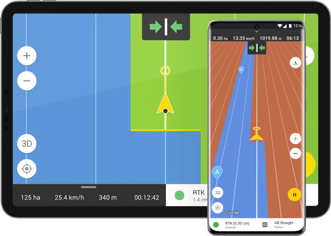
AB straight (free)
AB straight is suitable for regularly shaped square or rectangular fields without “non-operational spots”. In this case, our system will automatically draw parallel straight lines that you should follow on your field

AB curve
AB curve is suitable for all field shapes and particularly for fields with “non-operational spots”. In this case, you will make the first run along a curved/non-straight line. After the first turn, the application will create the next lines.
AB Manual
AB Manual pattern allows you to create the first line Manually even before the tractor drives into the field. In this case, our system automatically draws parallel straight lines to the line you created initially

Headland straight & curve
Headland is suitable for spraying operations. In this case, you will make the first run along the contour of the fieldset A and B points on one side. After driving around the field the application will calculate all lines for the field and will calculate the remaining area

Saved track
With the „Saved track” pattern, you can always return to the same line in the field. It is suitable to work in a field with a difficult symmetry. It enables you to use a previously saved track as the line for tractor guidance
See how it works at a glance
Avoid losses by acting smartly
Discover our features
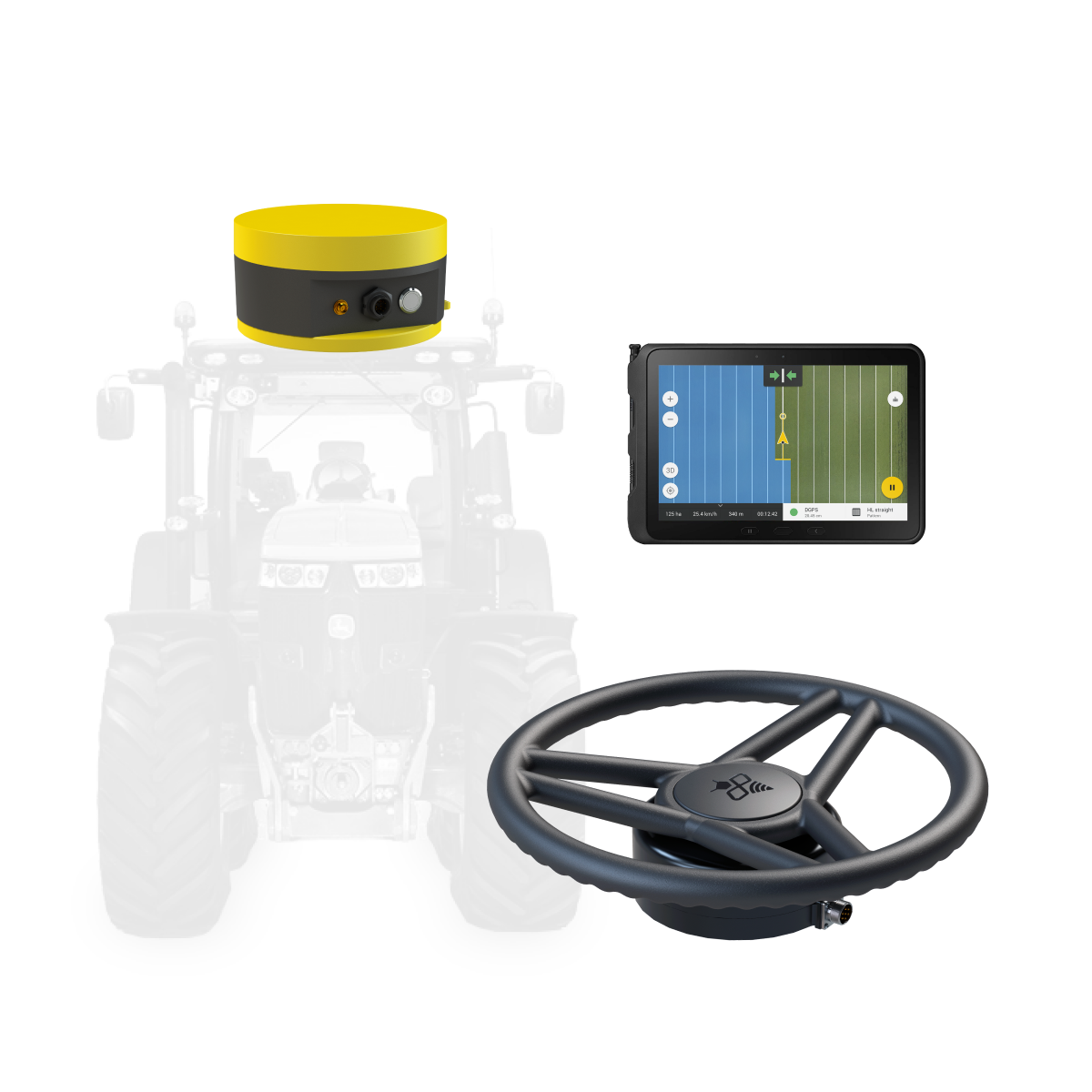
You can find many features in the app that will simplify your work in the field. Without using an external GPS antenna, the app will provide 2-3 meter accuracy (GPS accuracy of your phone/tablet). You can maximize your precision by connecting the app to the Fieldbee RTK receivers and autosteer kit.
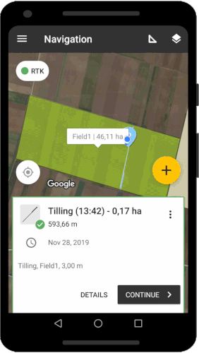
Record keeping
Save your work, create field records, and automatically generate reports.
Field records. You will be able to input the following data manually while working in the field:- Type of operation
- Denomination and quantity of materials used (fertilisers, pesticides, seeds, etc.)
- Type of operation
- Area and distance covered
- Machine used


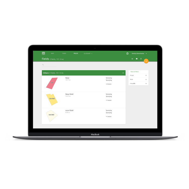
Mapping
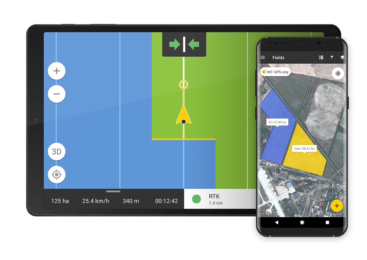
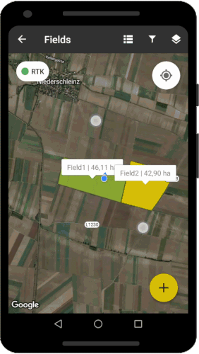
Create and manage field boundaries by Importing fields. Import your fields in the .SHP format in the web version of our application. Drag and drop available Cadaster documents. You can also manually draw the boundaries of your fields in the FieldBee app using Google Maps. While working with FieldBee, all information from your field works will be assigned to the particular field, stored in the secure cloud, and available at any time from any device.
Devices
All your devices synchronised

Desktop
Login on the FieldBee website and see all your data and records on your screen in your office. You will be able to download, copy and share your data without any restrictions.
Tablet
A tablet is more practical to use for working in the field. The larger screen and no distracting phone calls let you focus and achieve better results.
Smartphone
With record keeping and GPS guidance, you can use your Android smartphone to insert data into the system while working in the field.
Payment
Payment options
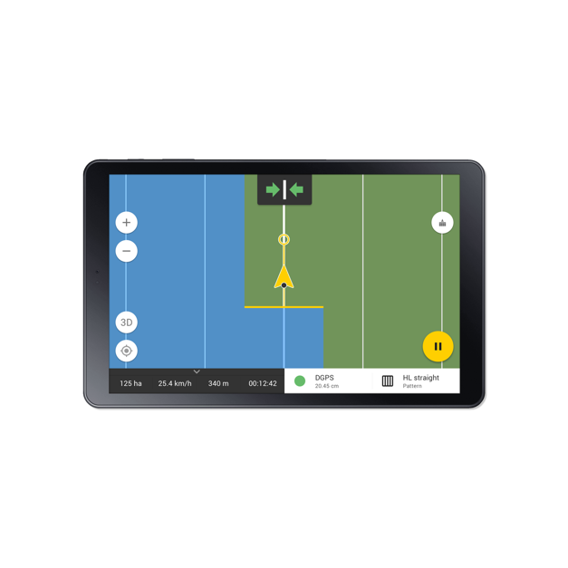
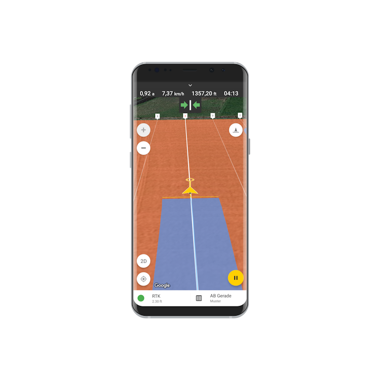
AB Straight
AB Curve
Guidance line
Navigation with asymmetric implement
Navigation with symmetric implement
Navigation with reversible implement
Line assistance
Path numbering
Shift line
Continue from the last position
Vehicles and implements list
Mapping
Task planning, progress tracking and reporting
Crops history
Record keeping and exporting in PDF
GPS
NTRIP (requires an NTRIP provider or the FieldBee Base Station)
ISOBUS from COJALI (Jaltest) with UT/TC-SC
AB Straight
AB Curve
Multiple Headland
Headland: Straight and Curve
Saved Track
AB from the side of field (copy side of the field)
Guidance line
Tram Line (coming soon)
Navigation with asymmetric implement
Navigation with symmetric implement
Navigation with reversible implement
Headland on a field
U-Turn
Line assistance
Path numbering
Shift line
Continue from the last position
Vehicles and implements list
Mapping
Task planning, progress tracking and reporting
Crops history
Record keeping and exporting in PDF
Record keeping and exporting in CSV and Excel
GPS
NTRIP (requires an NTRIP provider or the FieldBee Base Station)
Other farm GPS devices
ISOXML Importing with Prescription map
ISOBUS from COJALI (Jaltest) with UT/TC-SC
Basic
1 Month Subscription
new
12 Months Subscription
popular
60 Months Subscription
-20%
Navigation Patterns
AB Straight
AB Curve
Multiple Headland
Headland: Straight and Curve
Saved Track
AB from the side of field (copy side of the field)
Guidance line
Tram Line (coming soon)
Implement Profile
Navigation with asymmetric implement
Navigation with symmetric implement
Navigation with reversible implement
Headland Management
Headland on a field
U-Turn
Visual navigation assistance
Line assistance
Path numbering
Shift line
Continue from the last position
Task and field management
Vehicles and implements list
Mapping
Task planning, progress tracking and reporting
Crops history
Record keeping and exporting in PDF
Record keeping and exporting in CSV and Excel
Connection
GPS
NTRIP (requires an NTRIP provider or the FieldBee Base Station)
Other farm GPS devices
ISOBUS
ISOXML Importing with Prescription map
ISOBUS from COJALI (Jaltest) with UT/TC-SC
FieldBee offers automatic currency conversion from original EUR prices for international customers. This feature ensures prices are dynamically updated based on real-time exchange rates, providing accurate and transparent pricing. With this system, you can shop confidently, knowing you're seeing prices in your local currency without the trouble of manual calculations.


Contact us


Congratulations!
Your request has been successfully sent. Our representative will contact you shortly to clarify the details.
fieldbee
Elevate Your Farming Efficiency with FieldBee GPS Navigation

Precision farming thrives on GPS field navigation, empowered by cutting-edge digital technology. FieldBee offers farmers the key to significant time and cost savings through its multifunctional capabilities. To unlock its full potential, the synergy with precision agriculture software is paramount.
Our versatile tractor GPS app, designed for both desktop and mobile devices, is your comprehensive farming solution. Explore the possibilities:
- Accurate Field Navigation: Achieve seamless performance with parallel guidance in 5 distinct modes.
- Farm Field Mapping: Gather precise satellite-based data for your farm fields.
- Work Scheduling: Efficiently plan fieldwork and take notes directly within the app.
- Low-Visibility Support: Navigate with ease during night-time operations.
- Auto-Steering Compatibility: Seamlessly integrate with our FieldBee PowerSteer system on your tractors.
- Route Saving: Store pre-planned routes and tracks for future use.
Read more