Today, farmers from all over the world are beginning to implement new technologies in their operations to decrease operational costs, improve yields, and make their farms more eco-friendly. As a result, autosteering devices and other precision farming technologies are becoming increasingly widespread. While autosteer devices that use conventional GPS signals can reach about 20-30 cm precision, RTK systems such as FieldBee can use NTRIP signals to provide 1 cm precision at a more affordable price or even completely free in some places . In this article, we will talk about NTRIP technology and its benefits.
NTRIP - what is it?
Developed in the early 2000s in Germany, NTRIP, is a protocol used to transmit differential GPS data using the internet. Before this technology was invented, GNSS data was transmitted through radio signals. These older methods have significant drawbacks in comparison to the NTRIP technology.
How is NTRIP technology used?
NTRIP is widely used in surveying, geodesy, and agriculture to enable precise RTK positioning. As mentioned above, this method allows users to perform operations with 1 cm accuracy compared to 20-30 cm accuracy provided by conventional GPS systems.
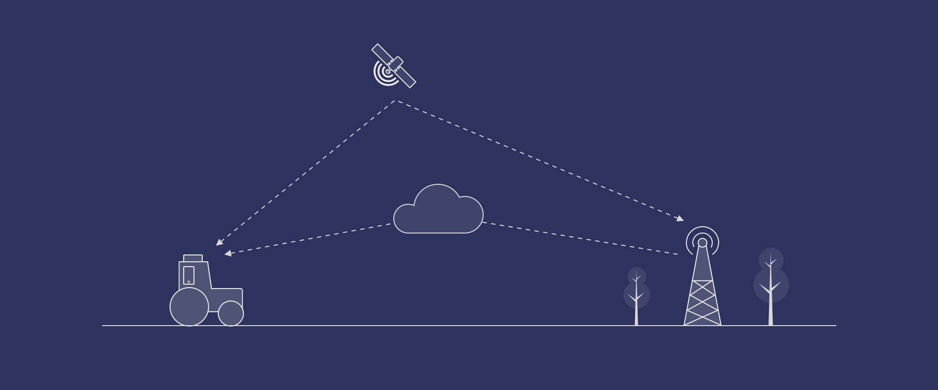
To utilize RTK positioning, users need to purchase an RTK GNSS receiver. This device will use NTRIP to receive location data from the RTK GNSS base station, which has known coordinates and height. The receiver will then use this information and satellite data to calculate its precise coordinates.
More and more users don’t need to purchase expensive RTK base stations, as more and more regions have NTRIP service provided by private entities or government bodies that run RTK Networks. This service can be paid or free to use, depending on the provider.
Pros and cons of NTRIP compared to radio signals
Pros:
- No need to carry heavy radio equipment with you while out in the field, as users connect to the internet using small portable devices such as tablets or smartphones.
- No need to worry about radio interference.
- No need to obtain a license, while some radios require it.
- Extremely long communication range compared to radio signals (for example 20km radius vs 2 km over radio). Cons:
- The area needs to have cell coverage to enable internet connection.
Concluding words
Just a few decades ago, high-precision location data provided by RTK technology was very expensive and available only to professionals in the engineering and surveying fields. But since NTRIP technology was discovered, internet coverage became widespread, and RTK GNSS receivers became smaller and more affordable, professionals in other fields received a chance to utilize centimeter precision in their work. For instance, in the agricultural field, this allowed more farmers to get access to precision farming practices, minimize overlaps and missing spots during field operations, decrease the time spent in the field, and, therefore, decrease operational costs and improve profitability.


